Starfish & Syke Hill
5.5 miles – 2.5 hours – grade 2+
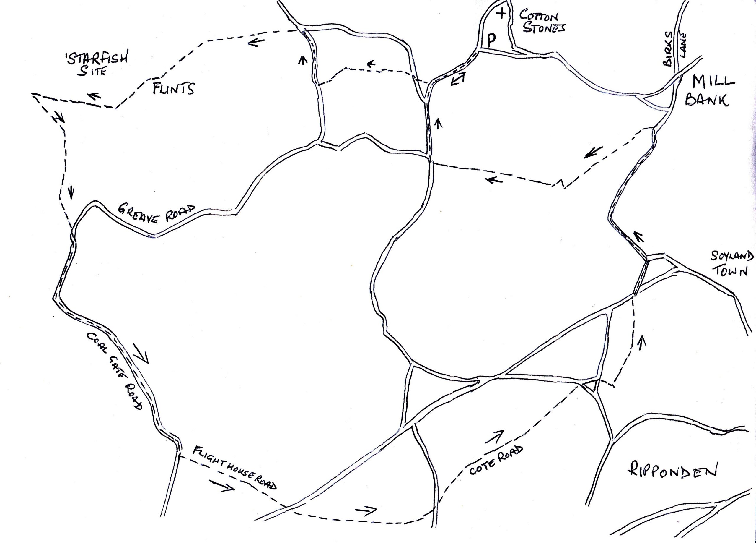
We start our walk from Cottonstones, above Mill Bank and Ripponden. There is parking near to the church or if you require refreshments afterwards, you can always park at The Alma Inn, just inform them you are doing a CREW walk and will call in later.
From ‘The Alma’ carpark, turn right and then left up Clay Pitts Lane, further up the lane, on your right are some stone steps into a field, cross the field onto Wicking Lane. Turn right and then left, following the way marker up through the buildings and onto a walked track, this will bring you onto Ash Hall Lane.
Turn right and walk along the lane to the wide track on your left, just before the tarmac road. Follow the track up and around to a T junction of paths, turn left and walk past the farmhouse on your left. You will come to a gate, once through take the right-hand path, to your left you will see the Flints, this will lead you towards a red-bricked building.
It is very difficult to imagine now but this area was a 2nd WW ‘Starfish’ site. A great area of the moorland and farm fields to your right, were made to resemble an airfield. Wooden planes etc were placed around the site so the German bombers would think it was a significant airfield. It was to deflect their attention away from the industrial areas of Halifax and the munition factories in the Greetland areas. At night, if bombers were in the area, great fires were lit, the German bombers would see this and fly towards it. There were 1500 such sites around the country.
Looking at the red-bricked bunker, turn left and continue down the wide track, passing the disused quarries and trees to a style taking you onto Greave Road. Keep right and walk along the narrow road – Coal Gate Road. The road will take a right turning and you will see a way marker to your left. The wide track is called Flight House Road, at the junction, cross the road and onto the wide track in front of you.
At the next junction turn left and then right on to another track – this is Cote Road and the area is Syke Hill. When the wide track stops, continue straight forward on a narrow path. When you reach a tarmac road, cross over on the narrow road in front of you, then cross over the tarmac road on to a track, turn left and walk down this track.
When you are approaching the houses, the path narrows to go past the back of the properties; there are several gates and sometimes the dogs are in the back yards, so make sure the owners come out to secure them!
You will come out on to Lane Heads Road, turn right and then left to descend Foxen Lane. At the bottom of Foxen Lane, in the very bottom of Mill Bank, you will see the stream and a path to your left which goes up at the back of the houses. This soon becomes a track through the woodland (this part of the walk is a little strenuous and graded 2+). At the tarmac road, turn right and follow the wide track up to the road.
You will come out at Lighthazles, turn right along Lighthazles Road, this will then join Clay Pitts Lane to retrace your steps back to The Alma Inn.